Ojai Valley and the January 2005 Flood - San Antonio Creek
Created 21 January 2006
This page last updated 6 January 2008
This is the second page of scenes of flooding within the Ojai Valley, with this page focusing on San Antonio Creek conditions on 12 January 2005.
CounterData.com

financial advisors Counter
All photos copyrighted by David L. Magney 2005-2006
Links to other Ojai websites
NOAA Weather website for January 2005 storms
Ventura County Watershed Protection District's website illustrating rainstorm data
Links to other Ojai Valley 2005 Flooding Pages - Ventura River
Ojai Flooding of 2005 Home
Ojai Flooding of 2005 Page 3
Photos and Video Clips of Flood Scenes Along San Antonio Creek Downstream of Ojai
As Thacher Creek passes through the Sieta Robles Tract, it will jump its banks and flood the streets and several of the houses in this tract before passing under Boardman Road and joining San Antonio Creek at Soule Golf Course.
![]()
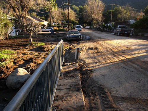
Three days after the flood shown in the photos above, you can see all the mud that had been left behind by the flooding of the Sieta Robles Tract from Thacher Creek overtoping its banks.
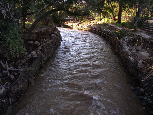
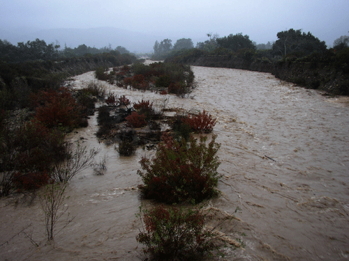
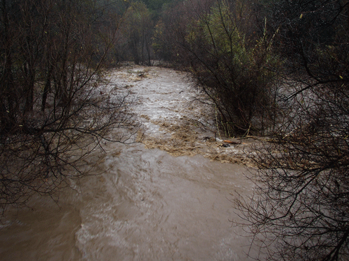
Upstream of Thacher Creek, San Antonio Creek is quickly eroding its unconsolidated levees on both sides of SR 150.
![]()
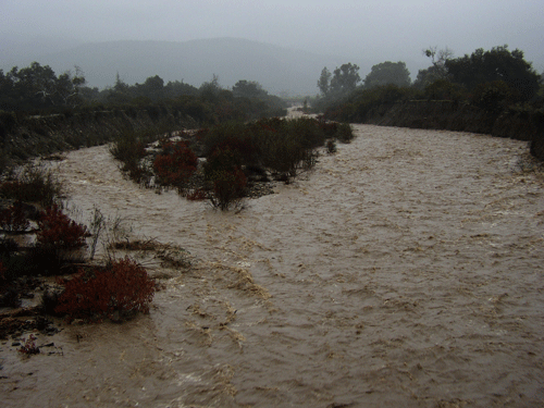
Downstream of its confluence with Stewart Canyon Creek, along the upper part of Creek Road, San Antonio Creek was lapping at the shoulder of the road, and at some point, flooded the road.
![]()
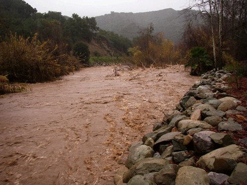
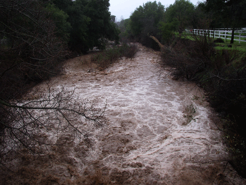
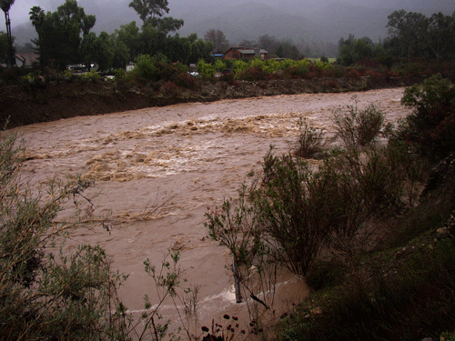
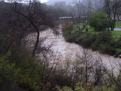
Just below Camp Comfort, San Antonio Creek was quickly widening its channel opposite the rock riprap that Ventura County Transportation Department had installed along Creek Road a few years before. The left bank (determined when looking downstream) is much further away then it was two days before this photo and video were taken, the result of serious lateral erosion, signs of an unstable and dynamic fluvial system. The lateral erosion occurs in part when the stream gradient is too steep and the stream water wants to level out, creating a meandering stream.
![]()
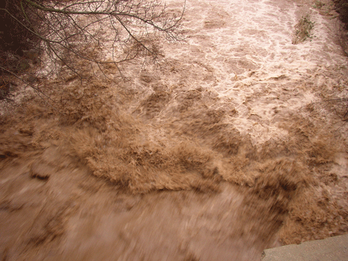
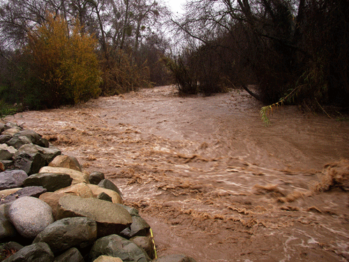
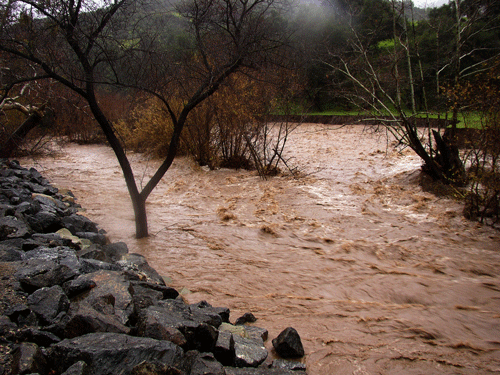
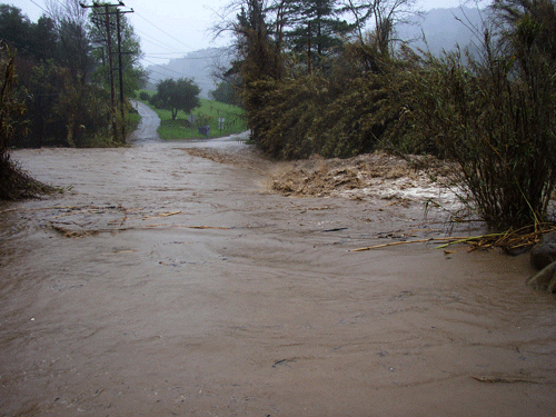
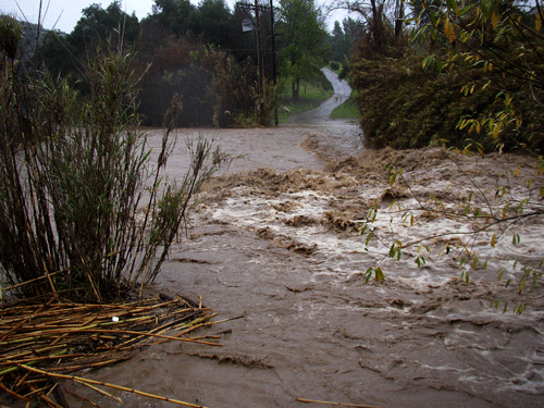
Here we can see the flood waters surging down San Antonio Creek just below the Dos Rios Ranch bridge about a half mile down from Camp Comfort.
![]()
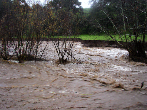
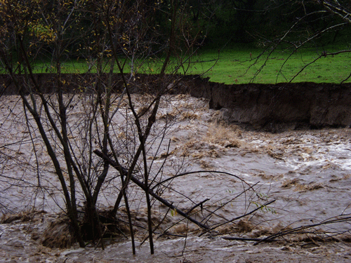
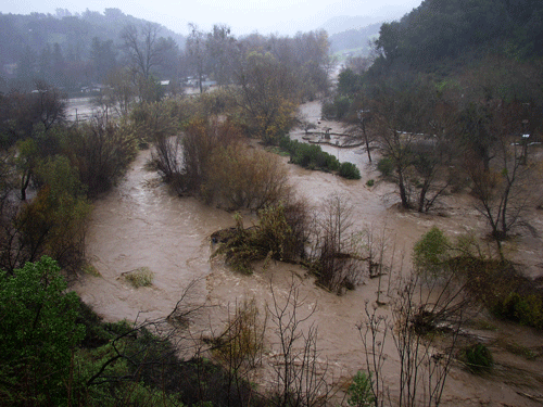
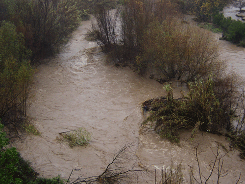
The lower portion of San Antonio Creek has overtopped its banks just above Rancho Arnaz.
So much for stopping by the Old Creek Ranch Winery for a glass of wine and a chance to dry off a little. There is no way we are getting across San Antonio Creek. This sign needed to be rewritten, road ends HERE!
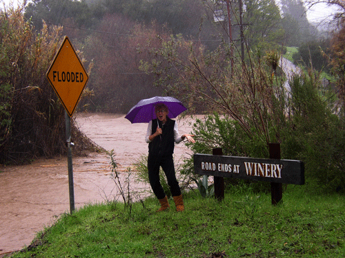
The water is over 8 feet deep at the Old Creek Road fair-weather crossing, and the conditions shown are do not qualify as fair-weather conditions. There was no way I was going to drive across this creek this day, no matter how good the wine is on the other side.
Ojai Area Home
Photography Home Page
Photography Site Map
DMEC Home