Many of the ridges and intervening valleys have been named; however, many have not. Placenames are valuable in explaining to others where something of interest occurs, such as a vista point, a population of an interesting plant, a place of historical significance, etc. Many places have uninteresting, or overly used names, such as Bear Creek, Dry Creek, Pine Mountain, etc., while other areas are more uniquely named, such as Nordhoff Ridge, Dry Lakes Ridge, Ojai Valley.
In recognition of the botanical research and longtime Ventura County resident and teacher, I decided it was time to recognize the life of Henry Minter Pollard (1886-1973). The photograph below is from a yearbook of Laguna Blanca School, supplied to me by one of his former students, Dr. Nicholas R. Miller, whose father was a fellow teacher at Laguna Blanca School in the early 1950s.

Henry, whom I never had the pleasure to meet, collected plants extensively in the Ventura River watershed, starting in the 1940s when he lived in Ojai. He had planned on publishing a flora of the Ventura River watershed in collaboration with botanist John Thomas Howell, but died, at the age of 88, before completing his manuscript and submitting it for publication.
Henry M. Pollard was born in Mendota, Illinois. He taught at several private schools in various places in California, and botanized everywhere he lived. While he lived in Ojai, he taught at the California Preparatory School between 1942, when the school opened in Ojai within the former The Foothills Hotel, until he moved to Santa Barbara to teach at the Laguna Blanca School on Hope Ranch in the early 1950s. His papers can be found at the Santa Barbara Botanic Garden (SBBG) library (Henry Pollard Collection) and many of his plant specimens are deposited at SBBG, Rancho Santa Ana Botanic Garden (RSA), and California Academy of Sciences (CAS).
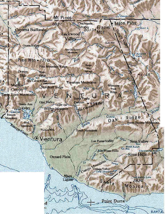
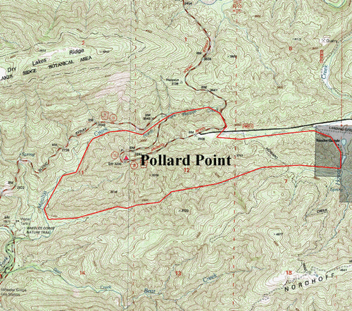
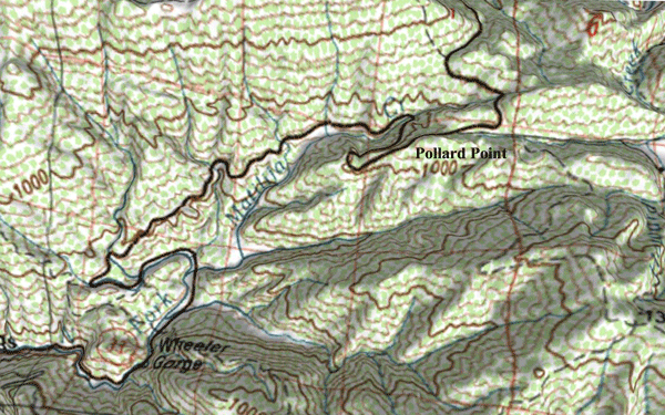
It seemed appropriate to honor Henry by naming a prominant unnamed ridge overlooking the headwaters of the Ventura River after him. Therefore, I made a formal nomination in 2004 to the U.S. Board on Geographic Names (USBGN) to name the ridge between Dry Lakes Ridge and Nordhoff Ridge just west of the Rose Valley turnoff along State Route 33 as "Pollard Point".
The Channel Islands Chapter of the California Native Plant Society, Ventura County Board of Supervisors, and the Channel Islands Regional GIS Collaborative, Inc., all supported my nomination as worthy, and wrote letters to the USBGN stating such.
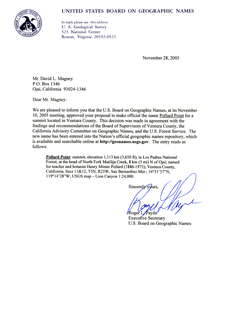
My application to the United States Board on Geographic Names was accepted and finally approved after a long vetting process on 10 November 2005. A copy of the official notification letter is posted below. How nice to have Henry M. Pollard honored in this way.
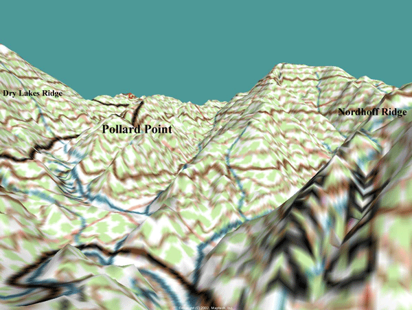
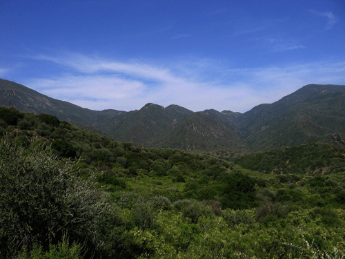
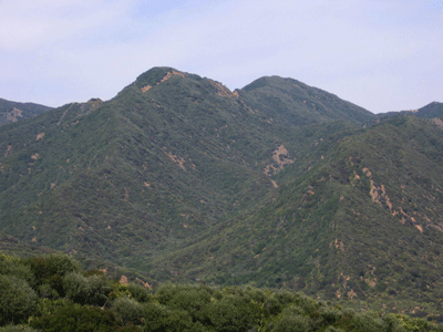
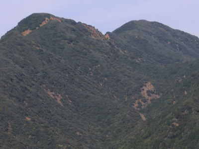
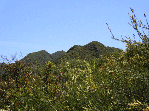
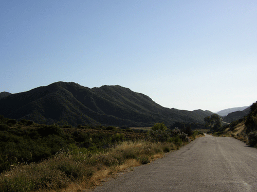
Pollard Point, located in the center of Ventura County within the Ojai Ranger District of the Los Padres National Forest, occupies approximately 1,000 acres (405 hectares). It is an east-west trending anticlinal ridge located south of Dry Lakes Ridge (to the north) and Nordhoff Ridge to the south. State Route 33 (SR33) climbs Pollard Point and provides an excellent view of the upper Ventura River watershed from the west end of Pollard Point.
Pollard Point is dominated by chaparral vegetation, with dominant plant species covering the steep slopes, including: Chamise (Adenostoma fasciculatum), Flatleaf Snowball Ceanothus (Ceanothus crassifolius var. planus), and Birchleaf Mountain Mahogany (Cercocarpus betuloides var. betuloides).
The geology of Pollard Point consists of marine sedimentary formations of Miocene and Eocene epochs (sandstones and siltstones), which have been uplifted and folded into an anticline (east-west axis), with faults occurring on the north south edges of the ridge.
Below are a series of maps and photographs illustrating the extent, topography, and character of Pollard Point.