Channel Islands Chapter
 Scenic Overlay Zone Problem
Importance of the Ventura County Scenic Resource Protection Overlay Zone
Ventura County created overlay zones several years ago for sensitive portions of the County. In areas with overlay zones, additional procedures of environmental review are required to ensure that particular resources are protected for the benefit of all Ventura County citizens. One such overlay zone is the Scenic Resource Protection Overlay Zone, designed to protect the viewshed from certain areas of the County, in this case, from lakes and highways. This overlay requires environmental review and permits for most land use changes on properties located on ridgetops visible from lakes/reservoirs frequented by the public. The overlay zone does not prohibit development in the areas of the County covered by them, it just requires that a landowner's proposed actions be reviewed first. Such regulations are needed to ensure that our government guides development of undeveloped lands in an orderly and appropriate manner. Below is a simple map showing the areas covered by the Ventura County Scenic Resource Protection Overlay Zones.
The Scenic Resource Protection Overlay Zone covers approximately 55,143 acres of unicorporated land in Ventura County, most of which is undeveloped, and much of that land used for grazing livestock, or single-family residences on large parcels. The map above includes city boundaries and major roads. It is clear that the overlay zone covers only a small portion of the County, yet the development activities that could occur in these areas could seriously affect the natural and visual resources from offsite. The Scenic Resource Protection Overly Zones are only in a few areas of the County, such as around the Ojai Valley, around Hidden Valley/Lake Sherwood, Lake Piru, Conejo Valley, and along State Route 33 north of Ojai (the portion designated by the State as a Scenic Highway). Another type of protection overly covers the coastal side of the Santa Monica Mountains, that portion that is within the Coastal Zone (pursuant to the California Coastal Act), and overlay zones to protect mineral resources.
There are a total of 1,870 parcels wholey or partially by the overlay zone, of which 389 parcels (almost all quite large) owned by a government agency, such as the U.S. Forest Service, or a land conservancy, such as the Ojai Valley Land Conservancy, and nonprofit entities such as the Boy Scouts of America. These 389 parcels total 39,620 acres, or 72% of the land. This means that only 28% of private property is affected in any way by the Scenic Resource Overlay Zone. When the parcel ownership is examined (based on 2006 data), 270 parcels, totaling approximately 1,966 acres (4%), is owned by land developers, oil companies, or other types of industry, not farmers, ranchers, or homeowners. This means that only 25% of the parcels within the overlay zone are owned by farmers, ranchers, or homeowners, and those families holding lands in trusts. Many of the remaining 114 parcels are owned by the same individuals, corporations, partnerships, etc., meaning that a very small percentage of the County's voting citizens may be required to apply for a permit, to the benefit of all the rest of the citizens of Ventura County. So, why are these few people given so much deference? Sounds like dirty politics, or ignorance by appointed or elected officials, or they have failed to do their jobs to satisfy the desired of the vast majority of Ventura County citizens. The citizens and the environment both loose when this happens, as occurred with the Sulphur Mountain Land & Cattle Company case described below.
Sulphur Mountain Violation
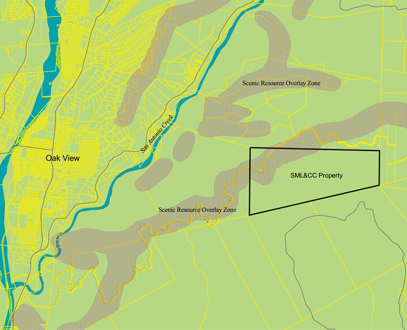
In the summer of 2011, the Sulphur Mountain Land & Cattle Company (SML&CC), which owns many acres on Sulphur Mountain, cleared natural vegetation from about 15 acres of the parcel without first obtaining a permit from the Ventura County Planning Division, resulting in a violation notice. Sulphur Mountain is the primary ridge on the south side of the Ojai Valley, much of which is visible from Lake Casitas, located in the western portion of the Ojai Valley. The western half of Sulphur Mountain is also visible from State Route 33 on the south heading north from Ventura. Below is a simple map of the western portion of Sulphur Mountain showing parcels (yellow outlines), the Scenic Resource Overlay Zones (magenta stippled areas), Ventura River and San Antonio Creek (blue areas), roads (dark gray lines), and the SML&CC parcel (thick black lined box).
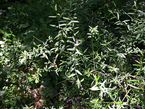
SML&CC used bulldozers to clear Coastal Sage Scrub and chaparral vegetation from the top of Sulphur Mountain, adjacent to and south of Sulphur Mountain Road, which is a popular hiking and cycling road open to the public. SML&CC is in the business of raising cattle for the beef industry. SML&CC's land, and most of Sulphur Mountain, has been used for livestock grazing for over 200 years now, beginning when it was part of the San Buenaventura Mission lands in the late 1700s. Tremendous damage was done to the natural vegetation and soils as the result of overgrazing, damage from which is still evident today in some areas.
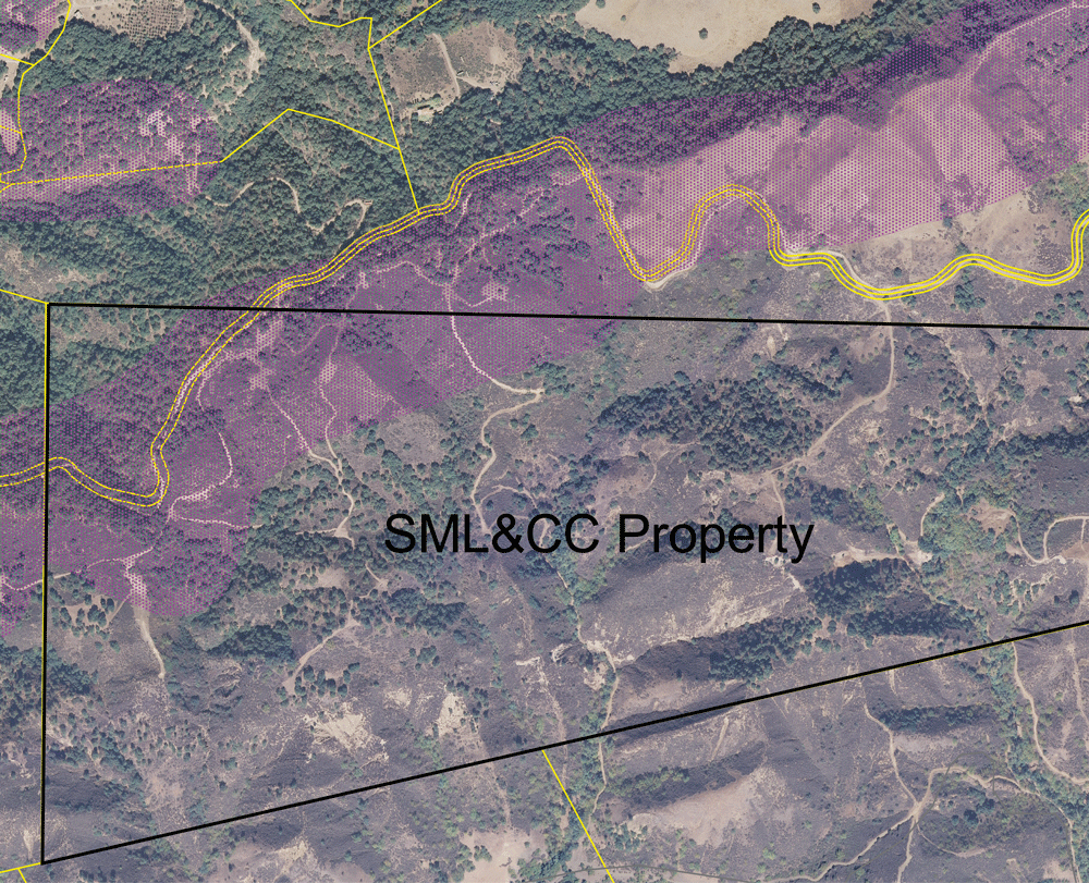
Much has been learned about impacts of overgrazing in the last 40 years or so, and SML&CC is said to be working to follow sustainable range management practices. Those practices do not consider the direct and indirect impacts of converting natural vegetation into forage "crops" to feed cattle. The principles of the "holistic" rangeland management are to maximize profit from the land in a sustainable manner, and ignore the needs of native plants and wildlife that occur there naturally, even with passive grazing by livestock. Below is a 2007 aerial photograph of the SML&CC parcel (black outlined) four years prior to their vegetation type conversion. The yellow lines represent parcel boundaries and the magenta stippled areas represent the areas covered by the Ventura County Scenic Resource Overlay Zone. As can be easily seen, the two dominant vegetation types on Sulphur Mountain are Coastal Sage Scrub and Coast Live Oak Woodland, with the later occurring primarily on the north-facing slopes.
SML&CC didn't want to be bothered with applying for a permit to convert the natural vegetation to non-native forage grasses, so, like Wild West cowboys, they just did what they wanted to do. Then, after receiving the violation notice, hired attorneys and consultants, and the right-wing radical group, Coalition of Labor, Agriculture, and Business (VCCOLAB) to fight the County during a tense election cycle. VCCOLAB is all about private property rights and anti-government, regardless what the majority of the population believes or supports. VCCOLAB certainly does nothing for labor or most forms of business in Ventura County, as their name implies. SML&CC appealed the Planning Director's decisions on the violation to the Ventura County Planning Commission (VCPC) in June 2012, which was heard by the VCPC on 16 August 2012. CNPS was the only conservation organization to provide comments/testimony, through the Environmental Defense Center. The public and environmental community was ignorant of the seriousness of the hearing. VCCOLAB members where out in full, including Supervisorial candidate Bob Roper, in favor of ignoring the County's planning rules and letting ranchers behave like Wild West cowboys and damm their neighbors. SML&CC is claiming that the natural vegetation on land that is grazed is a crop, and; therefore, can be removed at any time as "normal agricultural practice". Examining the definitions of crop (see link to online dictionary in last sentence) never mentions natural vegetation as a crop; rather, a crop is something that is planted and harvested. SML&CC converted the natural vegetation to a crop. We used to think it was okay to dump trash and industrial wastes into or rivers, which was certainly a normal business practice for decades. We used to do lots of things, which we don't anymore because we figured out that society suffered while only a few prospered. The rules of what is "normal" practice have changed, but not for cowboy operations like SML&CC. A video of the Planning Commission hearing can be viewed here.
Astonishingly, the VCPC, in a vote 4:1, upheld SML&CC's appeal, totally ignoring the facts and the law, and the sound reasoning provided to them by VCPD staff and the Director. Read the VCPD staff report here. This decision by the Commission was extremely short-sighted, and just plain dumb. They clearly didn't bother to actually read the law, or really even understand it, that except for the Commissioner from District 1.
This is incredibly bad for native plants and wildlife. This is incredibly bad for all citizens of Ventura County, except for those cowboy companies that own lots of land in the county that is covered by the overlay zone. CNPS only had 10 days to file an appeal to the Board of Supervisors; however, that would have cost CNPS $2,000 just for the filing fee, not to mention the additional funds needed to have CNPS represented by environmental attorneys. Since politics are so slanted in Ventura County that most of the Supervisors are afraid to cast any votes that appear to be against farming, we would likely have only gotten two votes in our favor, and then would have had to sue the County, at much greater cost. The entire environmental and social justice community needs to come together and correct this aggrecious error in judgement by the Commission and strenghten the SOAR Initiative regulations when they come up for renewal in the not-to-distant future. We can't let this terrible ruling stand.
Botanical Resources of Sulphur Mountain
Had the VCPC supported VCPD staff and the citizen's desire to protect important natural resources on Sulphur Mountain, the property owner would have found out that his property supported a diverse flora and fauna, and that several rare plants are known to occur on or at least immediately adjacent to where he bulldozed all the natural vegetation. David Magney previously compiled a list of all the plants known to occur on Sulphur Mountain, which is published on his Ventura County Flora website, as well on this website.
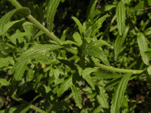
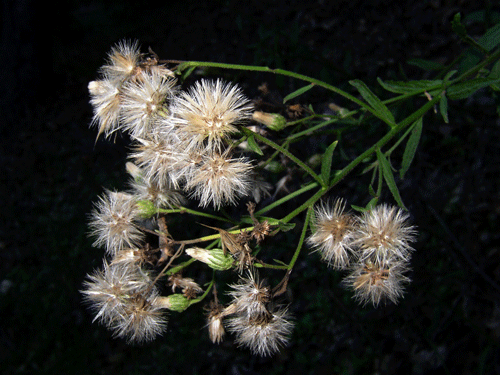
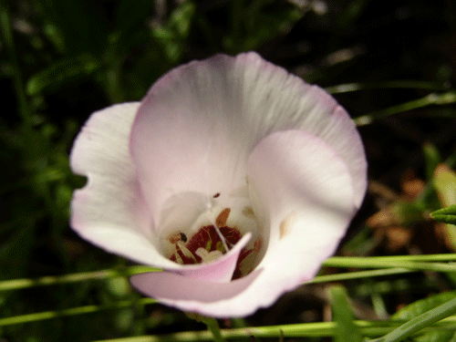
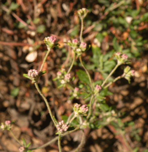
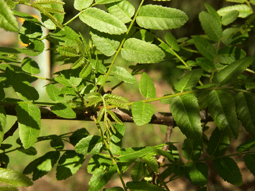
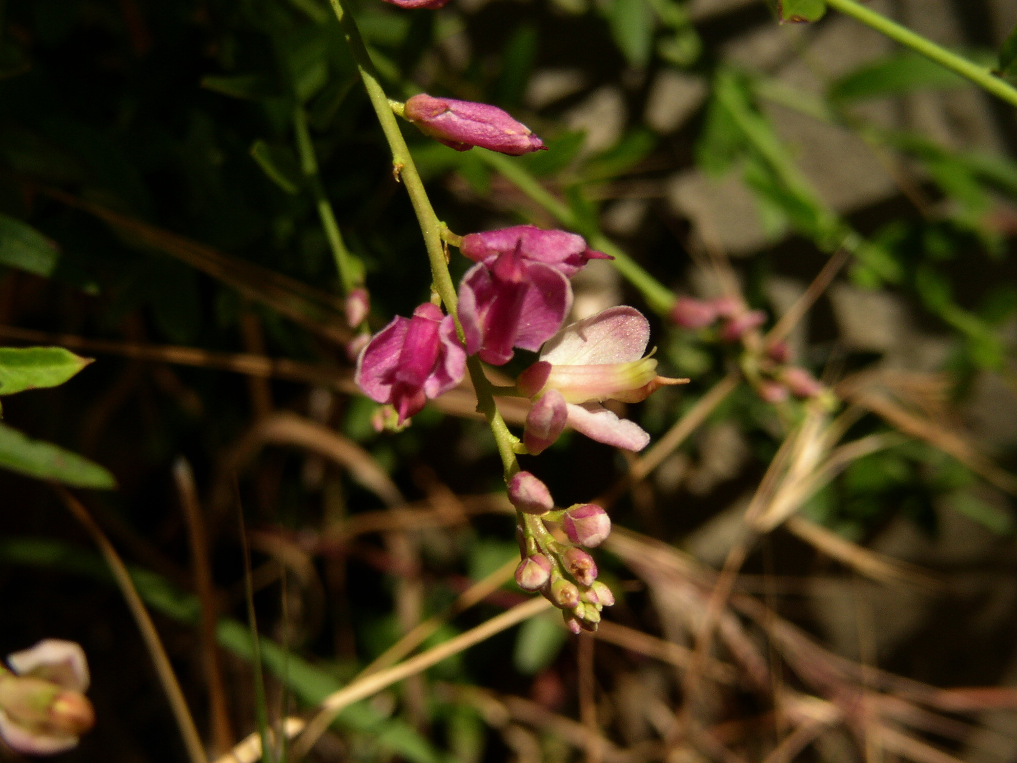
CNPS has regularly led field trips along Sulphur Mountain Road, including past SML&CC's property. Mr. Magney recently found several rare plants along the road, including some on the road through SML&CC's property. It is almost certain that one or more of these species were bulldozed during his vegetation type-conversion activities. Rare plants found include: Baccharis plummerae ssp. plummerae, Calochortus catalinae, Eriogonum parvifolium var. paynei, Juglans californica var. californica, and Polygala cornuta var. fishiae. Botanists, including the author, have found other rare plants on Sulphur Mountain (e.g. Aphanes occidentalis, Bromus laevipes, Elymus glaucus var. jepsonii, Galium californicum ssp. flaccidum, Navarretia ojaiensis, Ribes californicum var. californicum), one or more of which could be on the SML&CC property. Certainly, you would think that a landowner who was concerned about the natural resources on his property would find out what occurs on it before blindly changing the landscape.


More Information
Get more information from the following websites:
Watersheds Messanger IX(2): Home on the Holistic Range, 2002
Allan Savory's Holistic Management International
Organic Consumers Association: Sustainable Ranching--Grass Farming is the Wave of the Future
USDA's Sustainable Agriculture: Definitions and Terms
USGS: Fire & Invasive Species in Mediterranean-climate Ecosystems of California by Jon E. Keeley
Engelberg's 2011 Thesis: Anthropogenic Disturbance Regines & Coastal Sage Shrub Recovery
CHANNEL ISLANDS CHAPTER, CALIFORNIA NATIVE PLANT SOCIETY, PO Box 6, Ojai, CA 93024-0006
Special thanks to Carlin Moyer for the beautiful illustration of Toyon on this page.