CALIFORNIA NATIVE PLANT SOCIETY
Channel Islands Chapter
Channel Islands Chapter
Conservation Issue:  Cuyama River Mines
Cuyama River Mines
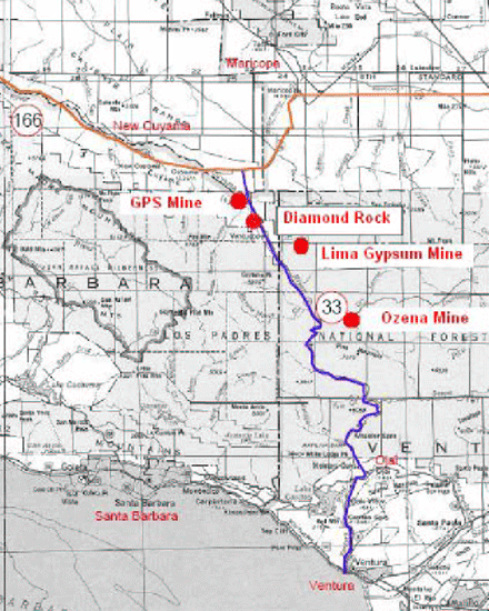
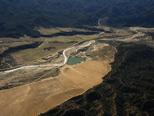
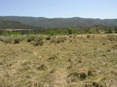
The Cuyama River, originating in northern Ventura County, the primary tributary to the Santa Maria River, has a large supply of sand and gravel that is of great value to the building industry and other construction-type projects. Currently mid-2007), there are two mines extracting sand and gravel from the Cuyama River, the Ozena Valley Ranch mine in Ventura County, and the GPS mine near Ventucopa in northeastern Santa Barbara County. Another large mine, Diamond Rock, is proposed near Ventucopa, just south/upstream of the existing GPS mine. CNPS is concerned about the adverse impacts such mines have on native plants and riverine and adjacent plant communities. Information about these mines and issues of concern to CNPS are provided below. Below is a general location map of the existing Ozena Valley, GPS mines, and proposed Diamond Rock mine located on the Cuyama River, as well as the Lima Gypsum mine in Quatal Canyon.
Ozena Valley Ranch Mine
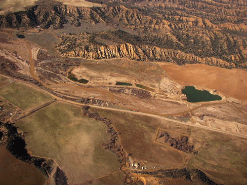
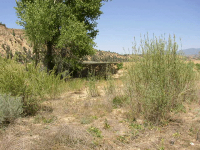
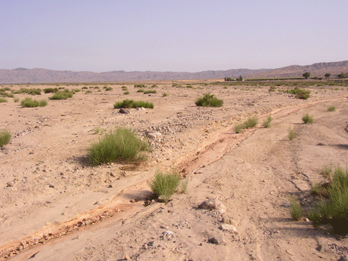
A small sand and gravel mine is currently extracting material from the floodplain of the Cuyama River in Ozena Valley, just north of Lockwood Valley Road. Ventura County Planning Division permitted this operation without requiring an Environmental Impact Report (EIR); rather, using a Mitigated Negative Declaration (MND), which can be very effective in protecting the environment. However, the public is generally not notified or given much opportunity, except for the very aware and deligent persons, to provide comment on projects. CNPS did not comment on this project primarily because a lack of public notice. Regardless, Ventura County Planning Division requires all such projects to be examined by a qualified biologist, on contract to the County, to identify issues of concern for biological resources. In this case, David Magney Environmental Consulting performed the Initial Study review and identified a number of sensitive biological resources of concern. Aerial photos of the site are shown below, the first from 2002 by AirPhotoUSA, and the others are oblique aerial photos by David Magney dated 14 January 2005.
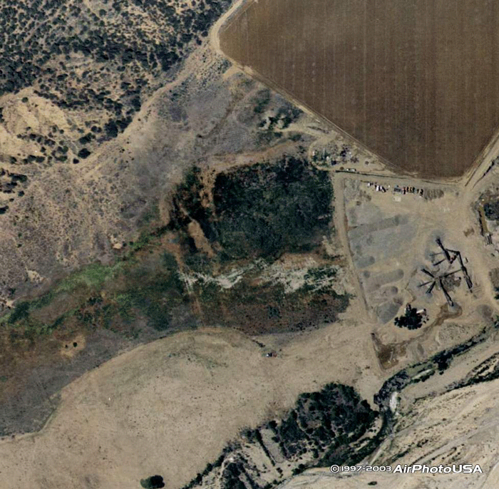
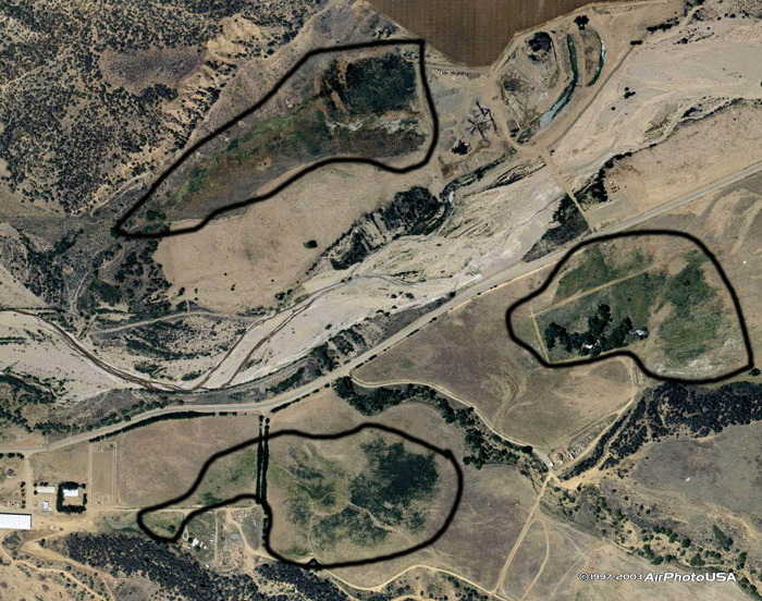
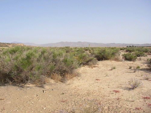
The Ozena Valley mine has two basic issues of concern to CNPS: 1) indirect and direct impacts to special-status plants, and 2) indirect impacts to the wet meadow immediately adjacent to the mine by a lowering of the shallow groundwater table. A large wet meadow is present in lower Ozena Valley, mostly on the Ozena Valley Ranch, adjacent to the Cuyama River. Historically, there was likely one large wet meadow; however, human activities over the last 100 years has likely fragmented the meadow and groundwater pumping has almost certainly reduced the size of the wet meadow. Alfalfa is grown extensively in the Ozena Valley, which is irrigated extensively from the shallow groundwater table of the valley, closely associated with the Cuyama River. A 2002 aerial photo of the lower Ozena Valley is shown below with existing wet meadow areas outlined, including the on adjacent to the Ozena Valley Ranch mine.
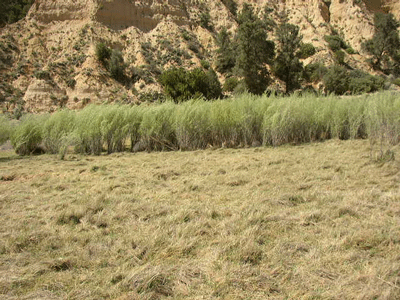
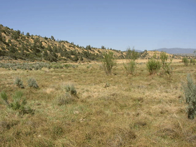
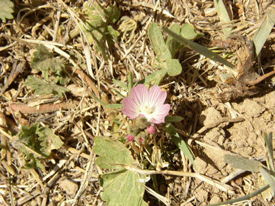
The wet meadow next to the mine is very unusal as a habitat in the Cuyama Badlands region, and elsewhere in Ventura and Santa Barbara Counties. It is dominated by Juncus balticus ssp. mexicanus with scattered Salix exigua (Narrowleaf Willow), as seen in the photos below. Furthermore, this wet meadow is habitat for at least one special-status plant species, Sidalcea neomexicana (Salt Spring Checkermallow), which is known from only one other location in Ventura County.
The mine has applied to expand its operations significantly; however, VCPD has decided that an EIR will be required to address two specific issues, truck traffic on State Route 33 and changes to the shallow groundwater. Contact Scott Ellison at VCPD to voice your concerns about this project.
Diamond Rock Mine
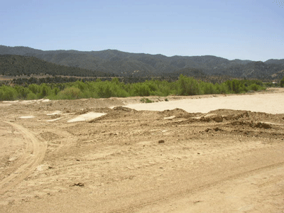
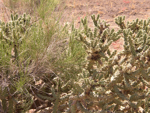
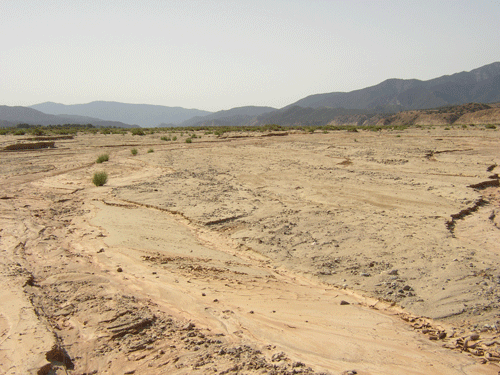
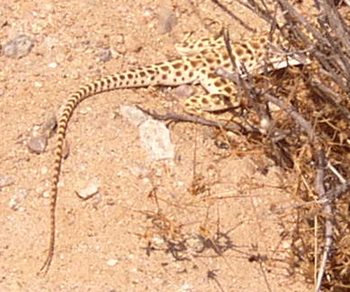
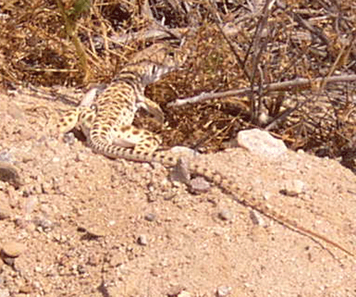
A relatively large sand and gravel mine is currently being considered for approval by the Santa Barbara County Planning & Development that is located in the Cuyama River just north of the town of Ventucopa, in northeastern Santa Barbara County. An EIR has been prepared for the mining project, and two public hearings have been held by the Santa Barbara Planning Commission on 30 May and late July 2007. Citizens of Ojai and the Cuyama Valley are very concerned about the project and how it will adversely affect their community's quality of life. CNPS provided comments on this project through written comments by David Magney Environmental Consulting, who reviewed the FEIR on behalf of the Stop the Trucks! Coalition and CNPS, identifying a number of sensitive biological resources of concern. A botanical survey of the project site found five (5) special-status plant species onsite; however, the preparers of the EIR somehow failed to mention them. They include: Astragalus asymmetricus (locally rare), Astragalus macrodon (CNPS List 4), Filago depressa (locally rare), Lessingia tenuis (locally rare), and Romneya coulteri (CNPS List 4). The mine site vegetation is primarily Scalebroom Scrub, dominated by Lepidospartum squamatum. This plant community is generally relatively sparse in total plant cover and is adapted to regular disturbance by flooding and fluvial processes. Besides plants, the mine site is habitat for the Blunt-nosed Leapord Lizard, a federally listed species, and other rare wildlife species. (Photos below by Cher Batchelor.)
The Diamond Rock mine has two basic issues of concern to CNPS: 1) indirect and direct impacts to special-status plants, and 2) indirect impacts to the floodplain scrub vegetation, as well as indirect impacts to riparian vegetation resulting from any significant lowering of the shallow groundwater table of the Cuyama River. Regardless, the Santa Barbara County Planning Commission voted 4-0 to approve the EIR and approve the project. Now the California Department of Conservation will review the mining and reclamation plan, which then must be adopted by Santa Barbara County before it can move forward to the next step. In other words, the Planning Commission basically ignored CNPS and the public about concerns of this mine, conditionally imposing restrictions on truck traffic using SR33 through Ojai. Concerns about impacts to rare plants, floodplain vegetation, and shallow groundwater drawdown were basically ignored.
Your help is needed to assist CNPS in properly challenging the lack of consideration and avoidance of impacts to native plants and sensitive plant communities this project represents. You can help by donating money and/or time to CNPS. Send a generous donation today to CNPS at P.O. Box 6, Ojai, CA 93024. Also, you can attend the public hearing in beautiful downtown Santa Maria and speak out about this project, or simply write a letter to the Santa Barbara County Planning Commission, Santa Barbara Board of Supervisors, and/or your elected representative. You will be impacted by one or more of these mining projects, no matter where you live due to the resources it will destroy or by the increased truck traffic and smog generated by the additional trucks to and from these mines.
More Information
Get more information from the following websites:
S.B. County Planning Diamond Rock FEIR
V.C. County Planning Division Ozena Valley Mine MND
Stop the Trucks! Coalition
DMEC Comment Letter on Diamond Rock FEIR
CHANNEL ISLANDS CHAPTER, CALIFORNIA NATIVE PLANT SOCIETY, PO Box 6, Ojai, CA 93024-0006
Special thanks to Carlin Moyer for the beautiful illustration of Toyon on this page.
For website comments: webmaster(at)cnpsci(dot)org
CNPS
HOME | SITE MAP | CHANNEL ISLANDS CHAPTER HOME