Cohan Development Lot 30 Wetland Delineation Photographs
24 February 2005
Below are selected photographs of datapoints where data were gathered on hydrology, soils, and vegetation in order to determine the presence or absence of jurisdictional wetlands and/riparian wetland habitat in Newbury Park (Thousand Oaks), Ventura County, California.
All photos copyrighted by David L. Magney 2005.
This page updated 16 May 2005.
Site Photographs
Wetland Delineation Plots A - B Photos
Wetland Delineation Plots C - D Photos
Wetland Delineation Plots E - F Photos
Wetland Delineation Plots G Photos
Cohan - Centex Development Site Maps
Figure 1. General Location Map of Centex Development Project Site
(published in the project site wetland delineation report)

Figure 3. Wetland Delineation Plots Surveyed for the Centex Development Project Site.
This map illustrates the wetland delineation transects (A through G) and corresponding datapoints/plots (e.g. A1, B3). The datapoints correspond to the wetland delineation field datasheets.

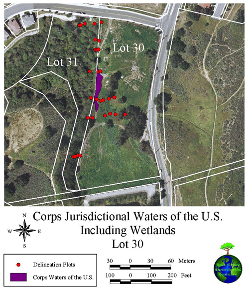
Figure 4. Centex Development Corps Jurisdictional Waters of the U.S., Including Wetlands.
This map illustrates U.S. Army Corps of Engineers jurisdictional wetlands onsite, plus wetland delineation datapoints used to make the determination.

Figure 5. Map of the CDFG Jurisdictional Riparian Wetland Habitat Area at the Centex Development Project Site.
This map illustrates California Department of Fish and Game riparian wetland area onsite, and wetland delineation datapoints.

Cohan Lot 30 Home
Photography Site Map
DMEC Home


