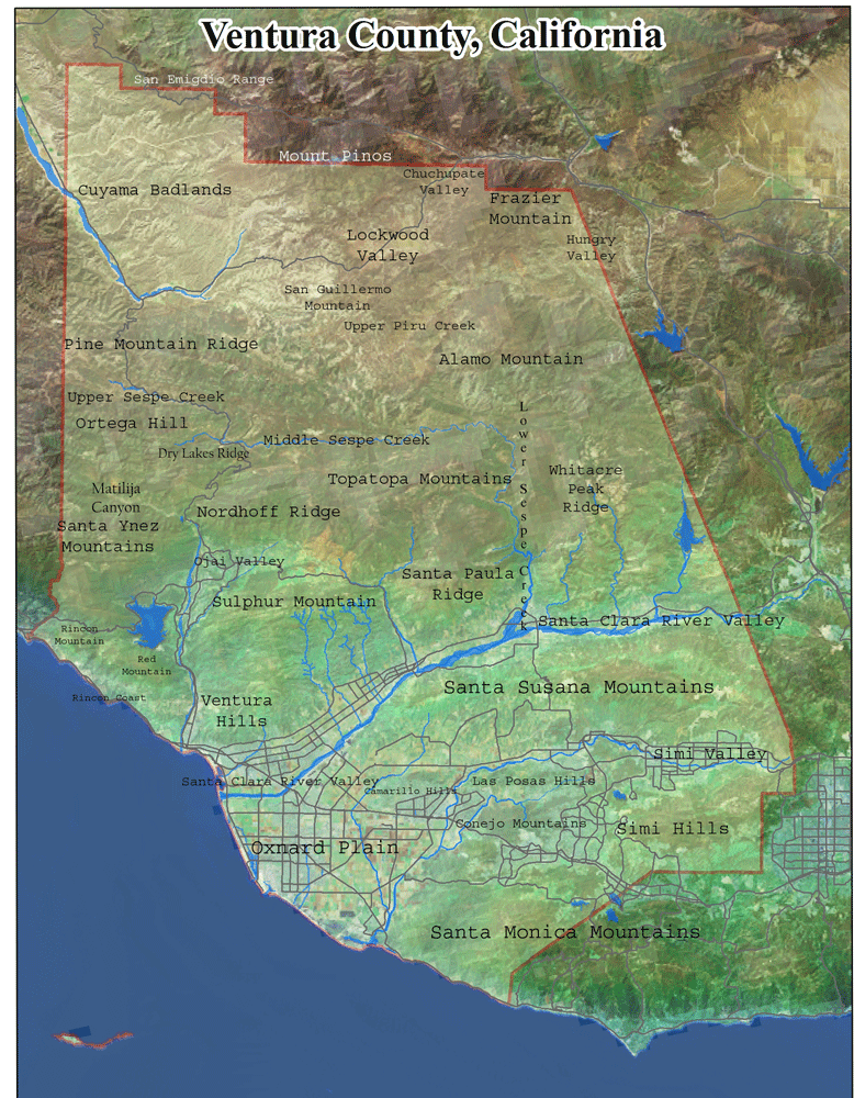
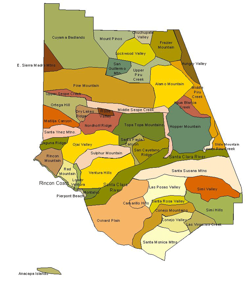
The Ventura County vascular plant flora consists of about 2,321 species (including subspecies and varieties) of native and nonnative plants. Ventura County is located between Santa Barbara, Kern, and Los Angeles Counties, and the Pacific Ocean, in southern California. Ventura County occurs within the Southwest Bioregion of the California Floristic Province. Selected plants of Ventura County are presented on the following webpages. Some of my checklists of plants from various parts of Ventura County are posted on the California Native Plant Society Channel Islands Chapter's website; however, the most complete website describing the vascular plant flora of Ventura County is on Magney's newly created Ventura County Flora website.
The flora of 2,321 taxa represents approximately 35% of the California flora. For an area representing only 1.2% of the state, this is a floristically rich part of the state. This is likely a result of the County's geographic position between northern and southern California, high topographic relief (sea level to 8,831 feet), and proximaty to coastal and marine climates and desert climates. Only Los Angeles County immediately to the east possesses similar attributes, but possibly to a greater extreme. However, Los Angeles County is also considerably larger than Ventura County. Due to the diversity and richness of the Ventura County flora, using the Nature Heritage Program's (NatureServe's) rarity ranking system, over half of the vascular plant flora is rare. Using this system to analyze the Ventura County flora on behalf of the California Native Plant Society (CNPS), I have identified and ranked each native plant taxon known to occur within the county. The results of that research and analysis is published as a checklist, updated at least annually. The checklist of locally rare plants of Ventura County is available below. Of the plants that are considered by CNPS to be rare statewide as published in CNPS's Inventory of Rare and Endangered Plants of California (6th Edition), Ventura County is habitat to 87 (4.2%) rare plants from a statewide perspective, and that number has increased since the publication of the 6th edition of the Inventory.
Below are links to additional web pages focusing on specific regions of Ventura County.
All photos copyrighted by David L. Magney 1978-2008.